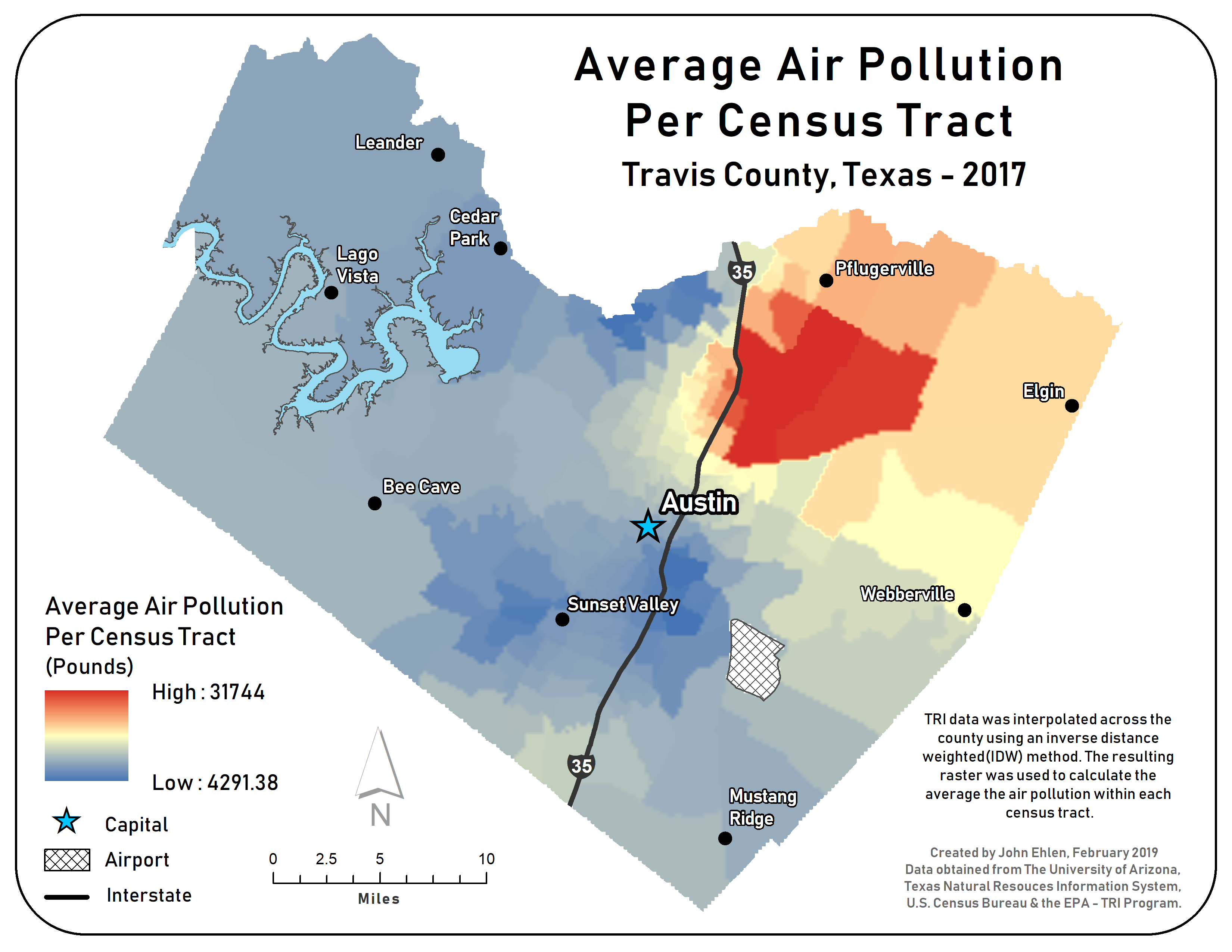
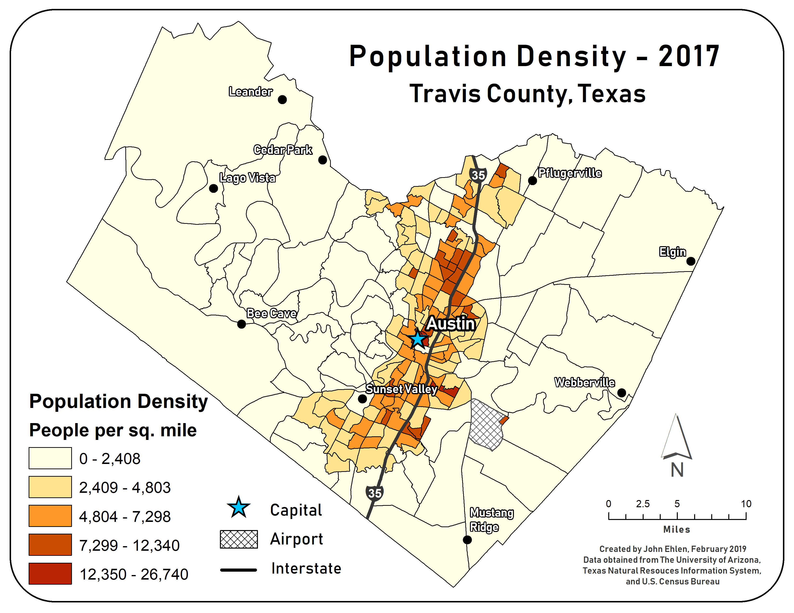
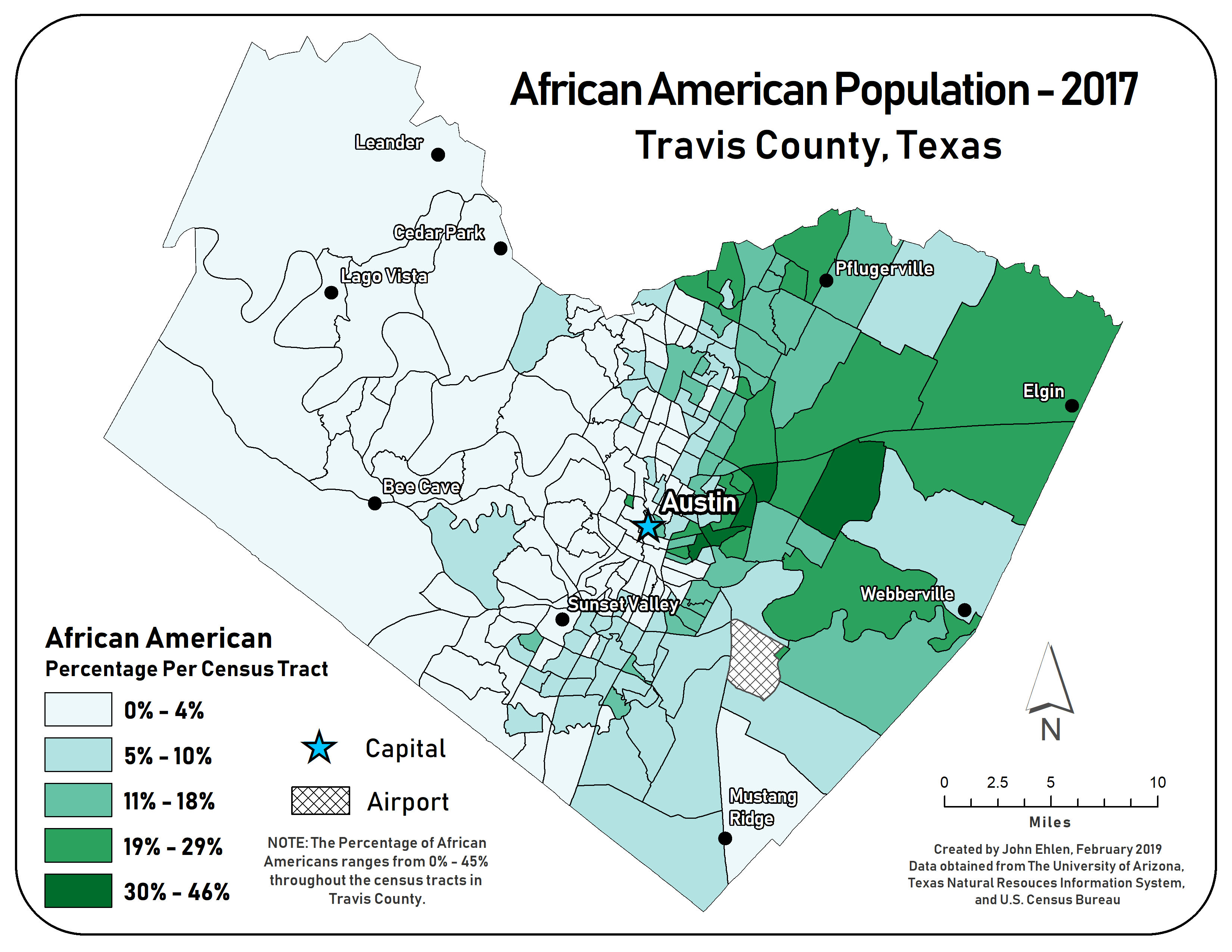
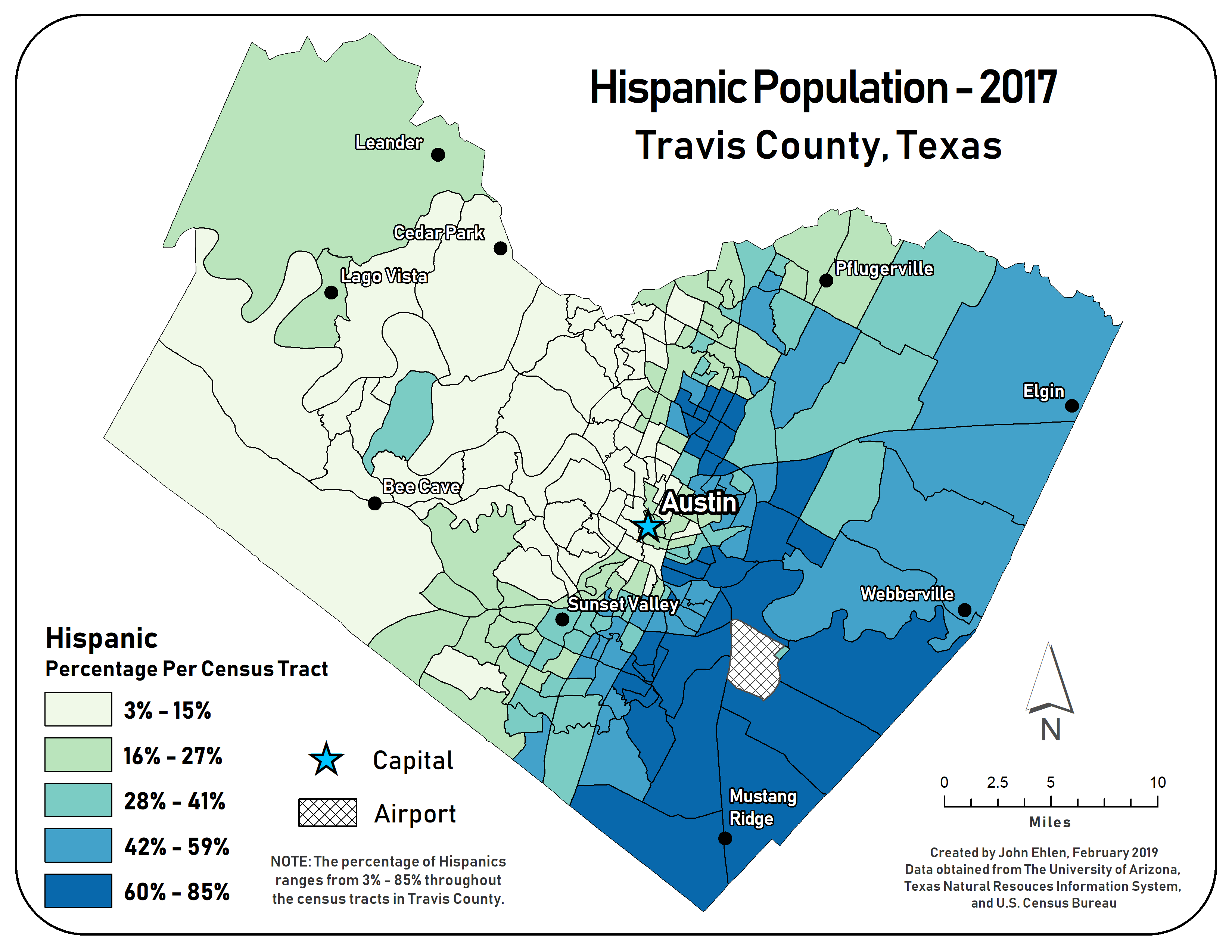
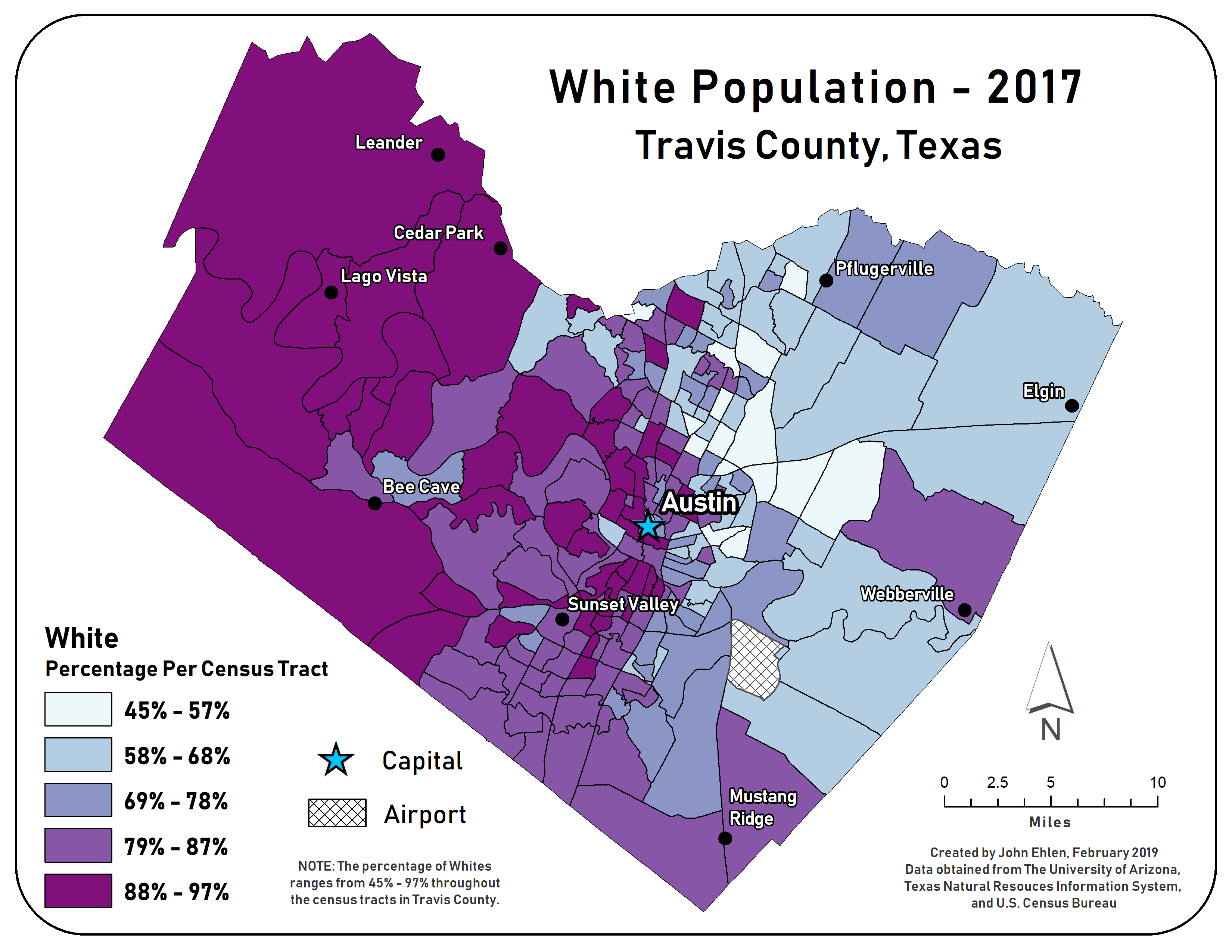
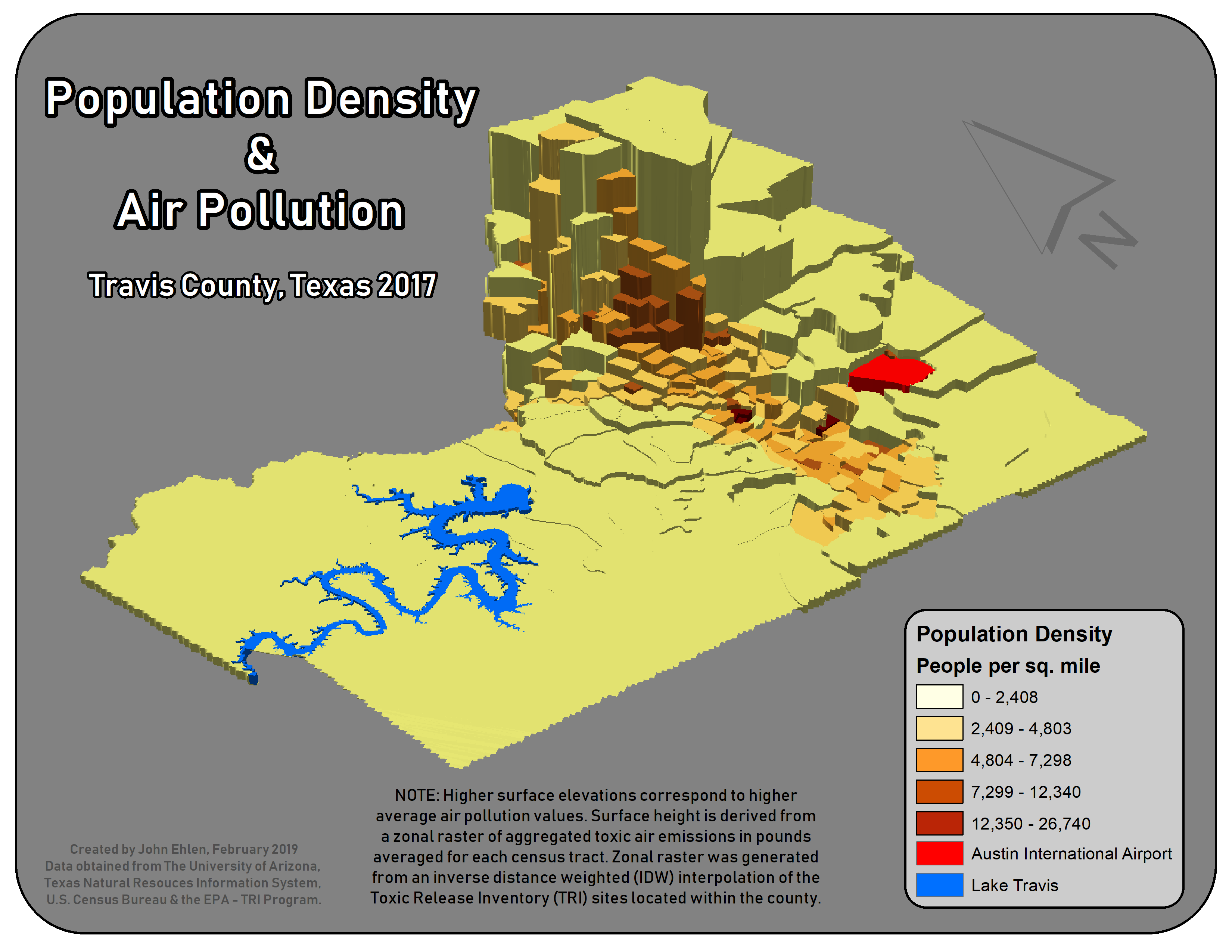
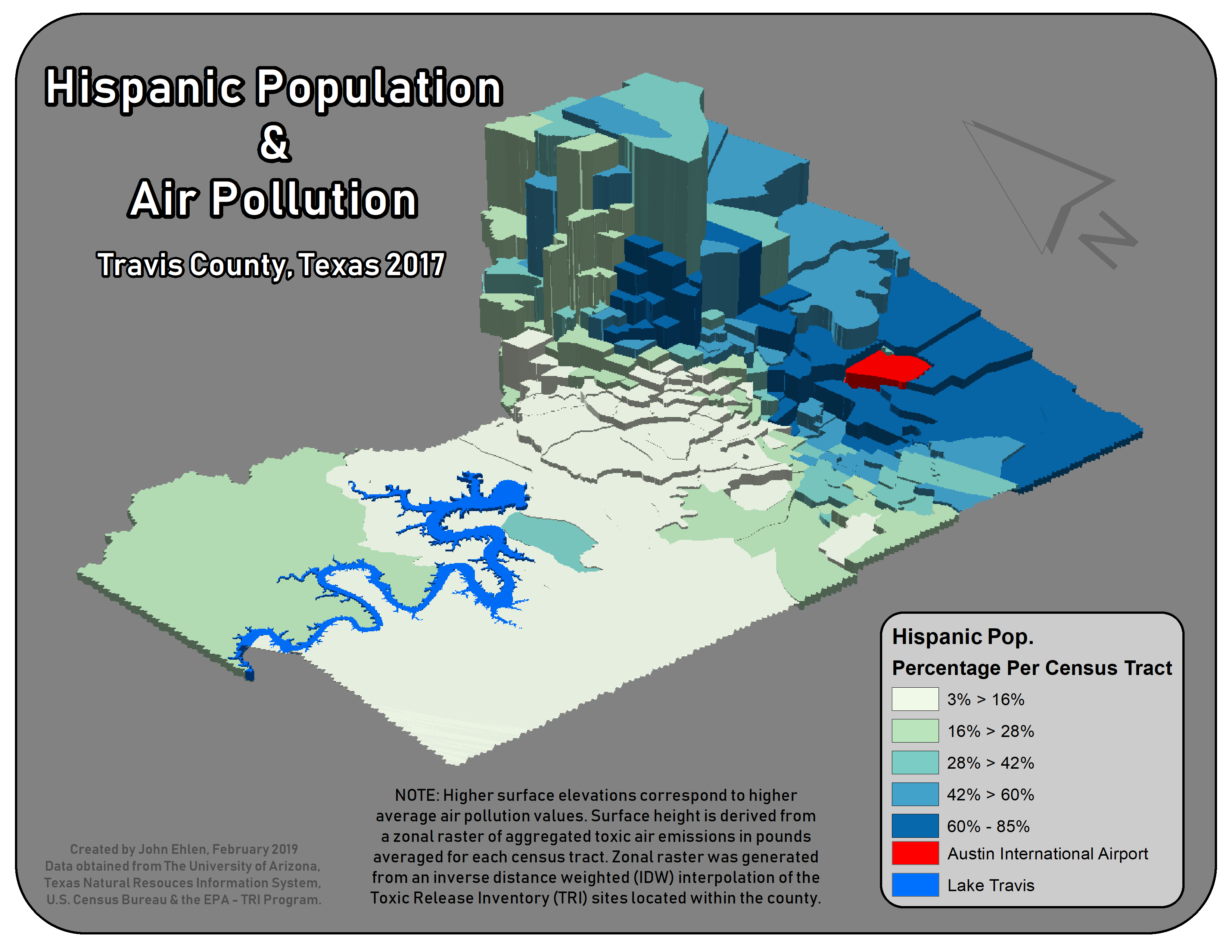
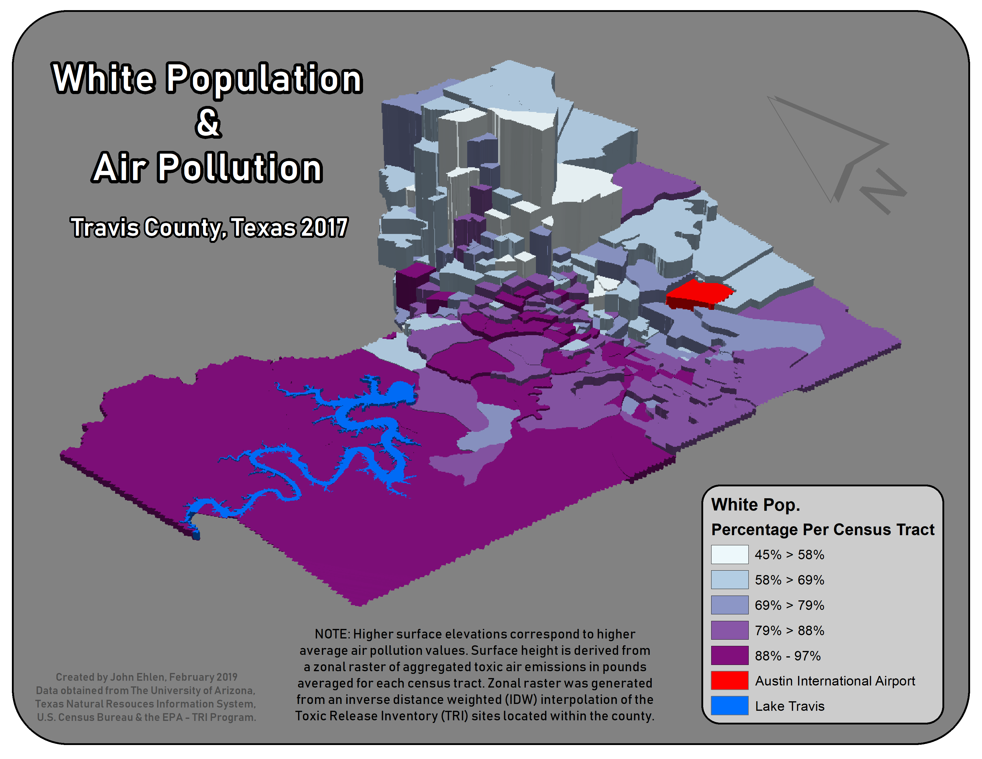
The goal was to explore the spatial relationship between concentrations of minority populations and their proximity to major pollution sites. No regression against pollution was run; the autocorrelation reports show that members of each group tend to live near one another.
Spatial analysis · graduate coursework · 2019
Environmental justice analysis, Travis County, Texas
A study of where major pollution sites from the EPA Toxics Release Inventory sit relative to where people live, by population density and race, with a spatial autocorrelation report for each group.
- 11
- maps, from air-pollution zones to 3D population surfaces
Results
- Very high spatial autocorrelation within each group mapped.
- Originally published as an interactive story map.